Parish History
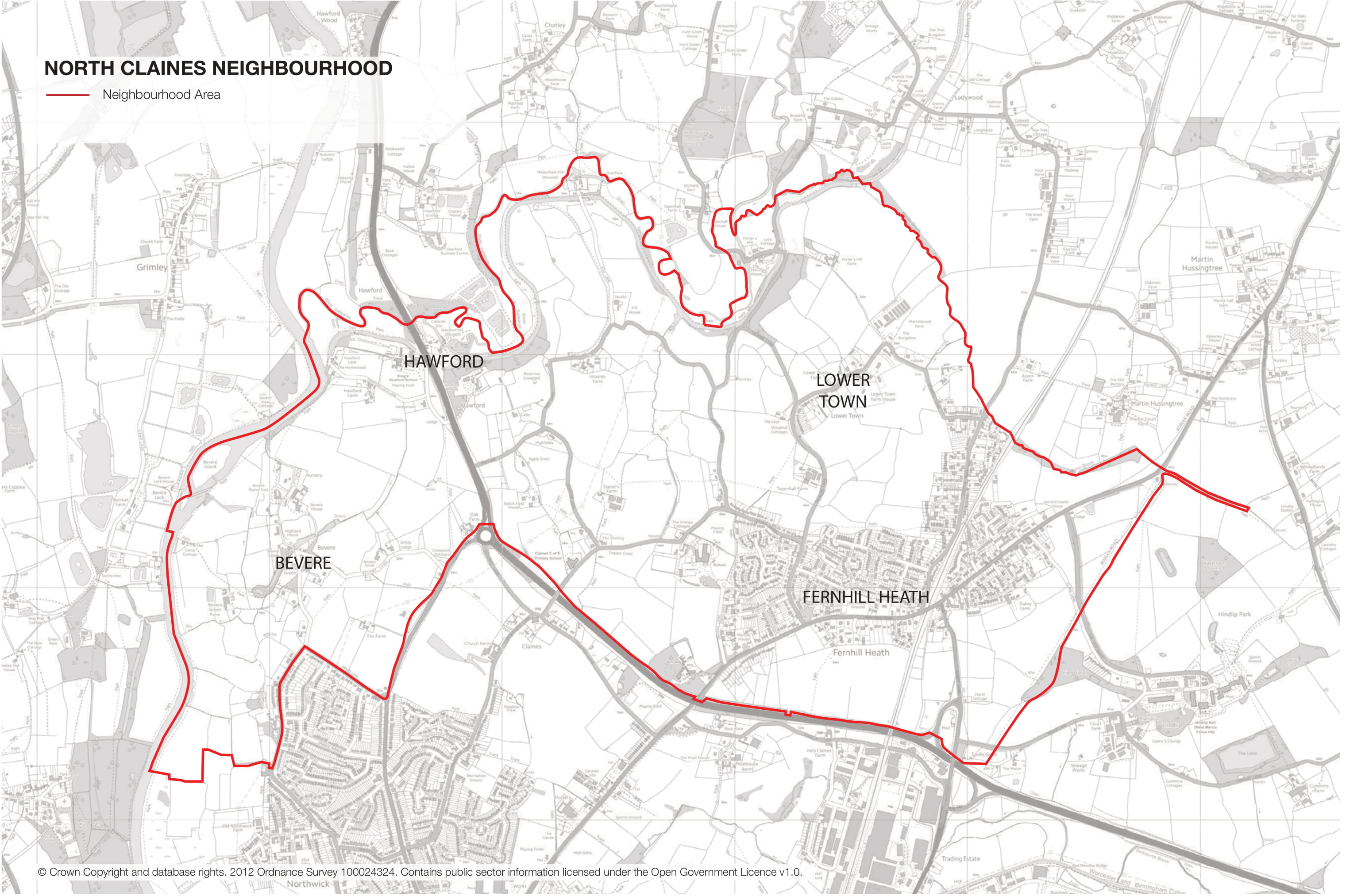
The Parish of North Claines covers the Parish of North Claines. This includes the communities within Fernhill Heath, Bevere, Lower Town and Hawford.
Historical Development
The current Parish of North Claines was created in 1885 when the previous Parish of Claines was divided into two. The southern half of the old Parish was added to Worcester City under the Worcester Extension Act 1885.
The ordnance survey plan of 1886 shows the settlement of Fernhill Heath centred along the Droitwich Road to the east of the railway line with the beginnings of development along Station Road to the west of the railway line. The majority of the development lines the Droitwich Road. The Bull Inn, the White Hart Inn and the Mission Hall are all identified on the Plan.
Other hamlets within the Area including Bevere, Hawford and Lower Town consist of individual properties within relatively large estates. There are also a number of individual farmsteads within the Parish.
During the next 80 years there was relatively slow incremental growth within Fernhill Heath. This is primarily along Droitwich Road to the west of the railway line and along Station Road. By the early 1960s the first major incursion from this ribbon development occurs with the Morton Avenue and Morton Road development to the west of Dilmore Lane.
The last 40 years has seen significant growth within Fernhill Heath with development moving further northwards from Droitwich Road into the open countryside. The Green Belt land, designated in 1975, to the south evidently providing the protection to the countryside in this location. The northern periphery of Worcester and in particular the suburb of Northwick has encroached up to the south-western boundary of the Parish.
In addition the last 40 years has seen some key infrastructure provision within the Parish. This includes the A449 trunk road along the southern boundary. This links with the A38 at the Oak Farm roundabout which continues south into Worcester. The A449 links with the M5 at Junction 6 and continues north to Kidderminster and Bromsgrove.
Within the same period Fernhill Heath lost its railway station which had been located off Station Road to the north-east of the village.
The Parish Today
The parish covers some 3,403 acres (1,377ha) or 5.3 square miles, is located immediately adjoining the northern boundary of the City of Worcester. It is some 2.5 miles wide in an east-west direction and 1.4 miles long in a north-south direction.
The western and much of the northern boundaries of the Parish consist of the rivers Severn and Salwarpe. The Droitwich Canal runs alongside the river Salwarpe. Both rivers have relatively wide floodplains.
The principle village in the Parish is Fernhill Heath which has a population of 3,256 (2011 Census). This represents 92.5% of the population within the parish. The remainder of the population live in the hamlets of Bevere, Lower Town and Hawford and isolated farmsteads.
The village is predominantly residential although it contains a small level of amenities including a first school and two private schools.
To the north and east the Parish is bordered by three parishes; Hindlip to the east, Martin Hussingtree to the north-east and Ombersley to the north-west.
To the west of the Parish beyond the river Severn is the District of Malvern Hills.
North Claines Population Profile 2001 and 2011 Census Table
The total population within North Claines NPA is 3,520 (2011 Census). There has been an increase of 13% in the resident population since 2001 (3,109 population). This is a much more significant increase than within Wychavon District which only saw a 3.5% increase in population and the West Midlands which had a population increase of 6.4%.
In terms of ethnicity, North Claines has a large white British population with 95.6% classified within the 2011 Census. The remainder is a mix of ethnicities including white non-British, Asian, black and other ethnic groups with no one group having a significant proportion of the 4.4% of the population.
There were 1,483 dwellings within the North Claines NPA according to the 2011 Census. North Claines has a significantly higher amount of detached houses compared with Wychavon and the West Midlands. Over half of the dwellings within the Parish are detached. Conversely, there are significantly lower proportions of terraced housing within the Parish compared with Wychavon and the West Midlands. There are slightly higher proportions of converted flats than the two comparators and the proportion of semi-detached houses and purpose built flats are similar to Wychavon.